The route:
I had already briefly talked about the GDMBR route in the first post. It starts in Banff, Canada, and heads through the beautiful Canadian Rockies, going through the provinces of Alberta and British Columbia. I am most looking forward to this part of the trip knowing how beautiful it can be. Linda and I had done a trip there a few years ago with our campervan, and saw some amazing scenery. I had taken some of my best landscape photographs along the way.
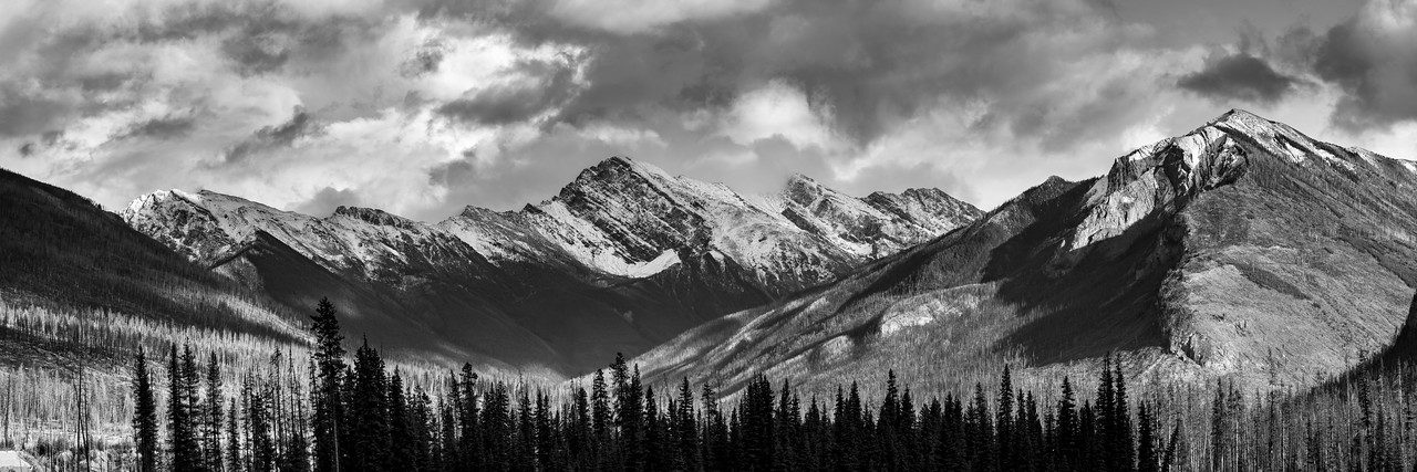
Canadian Rockies
The route then heads further south and crosses the Canada/US border near Roosville. It wanders through Montana before briefly entering Idaho, and then goes into Wyoming near Grand Teton National Park, which is probably my second favorite place with the majestic Teton mountains.
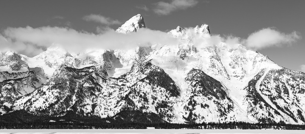
The Grand Teton mountains
Also, I’ll be in Grizzly bear territory starting near Banff until I get further south in Wyoming. Yes, I’ll make sure to carry bear spray and have a loud bell ringing from my handlebars.
After Wyoming, I will enter into our home state of Colorado, but not before crossing the Great Basin in the middle of Wyoming. This will probably be the most desolate stretch of the entire trip with no services for at least 170 miles (270 km). Lots of nothingness, wild horses, and plenty of wind. I crossed the Great Basin (on pavement) on my 2017 ride across the US, and I still remember those winds..😱 I hope to survive that stretch, and meet Linda and our dog Blue in Steamboat Springs, Colorado for some probably well needed R&R.
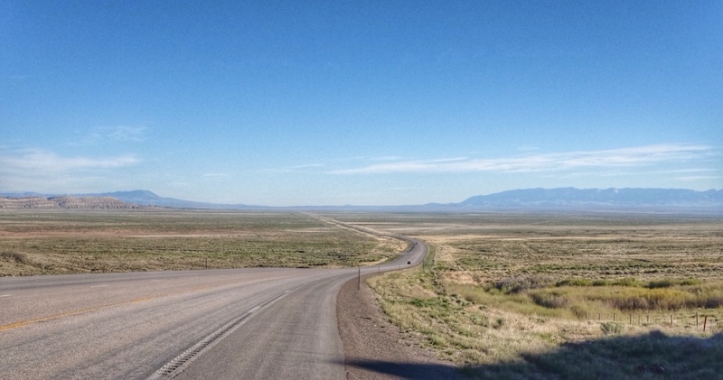
The Great Basin in Wyoming on on my 2017 Trans America bike ride
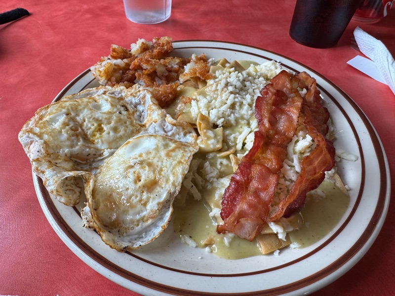
Then, if I am not tempted to put the bike in our car, and head home with Linda, I will cross Colorado into New Mexico. The comments from previous GDMBR riders is that New Mexico is the hardest state to cross. Weather can vary from sub freezing at higher elevations, to extreme heat and dryness further down. The biggest worry is to avoid some of the predictable monsoons that happen that time of year which creates this “peanut butter mud” that sticks to everything, and stops you dead in your tracks.
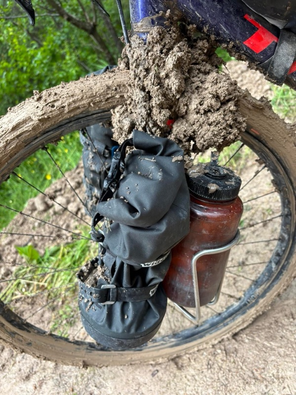
Peanut butter mud..
If I make it past that point, I simply point my front wheel south towards the Mexican border. I mentioned the finish at Antelope Wells, but I will probably opt for the newer alternative finish which is in Columbus, New Mexico. It is a small town, but at least there are people that live there, and it seems they are excited for having more bicycle tourists visit their town. Hopefully they know that we all must smell pretty bad by the time we roll into town...😷
Ok you ask, but when will you be done? In all honesty I don’t have a clue, but you will one of the first to know.
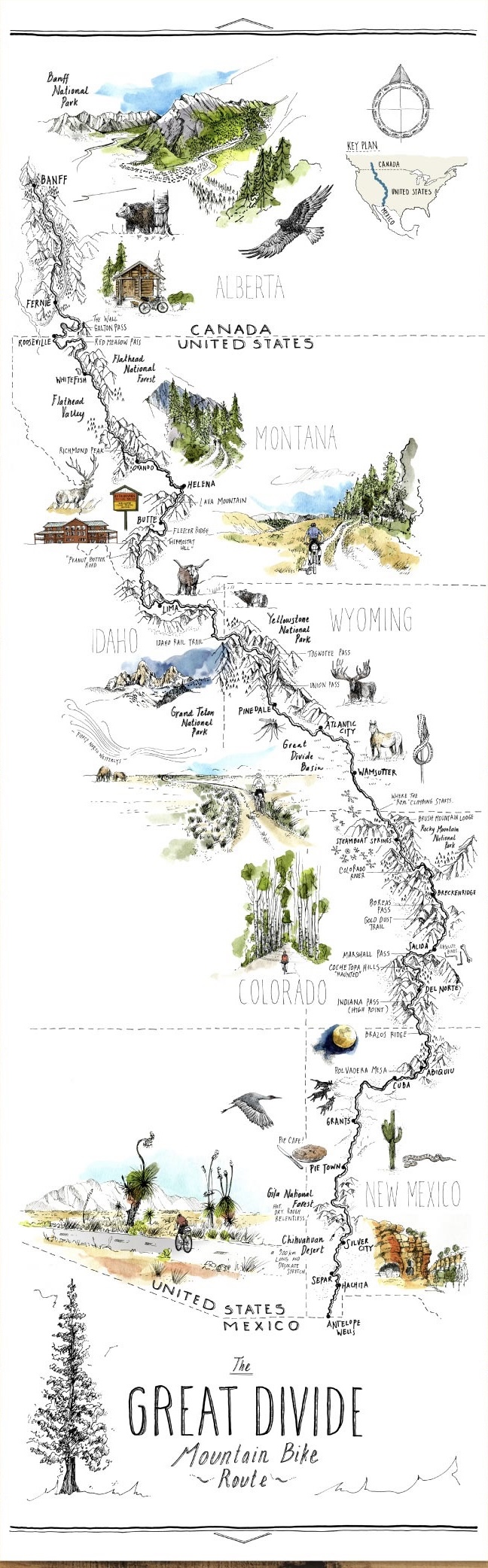
I found this very artistic map of the route on Bikepacking.com of which I am a member. I hope to eventually get a nice print of that when it is all over (all assuming I finish the darn thing).


No comments:
Post a Comment